Trail Conditions
The Border Route Trail offers a unique wilderness hiking experience. Navigation can be challenging and should only be attempted by experienced backpackers and wilderness travelers.
Please reference our Hike Planning, backpacking and day hiking webpages for other important information.
Seasonal Considerations
**NO WINTER UPDATES**
Blackflies and mosquitoes can be bothersome in June and early July. Ticks tend to peak in May and June but may be found anytime the temperatures are above freezing.
Weather in northern Minnesota is unpredictable and can vary from one place on trail to another. Snow can linger into May. Cold rains can occur in July and in the middle of winter. Frost can arrive as early as Labor Day and the last signs of summer can be as late as early November. Here are some general trends, though:
Spring: Snow often lingers into mid- to late May. Post-melt mud can be disheartening to hike through.
Summer: Smaller water sources sometimes dry up in late summer. In very dry years, a fire ban may be in effect. Expect portions of the trail to be overgrown.
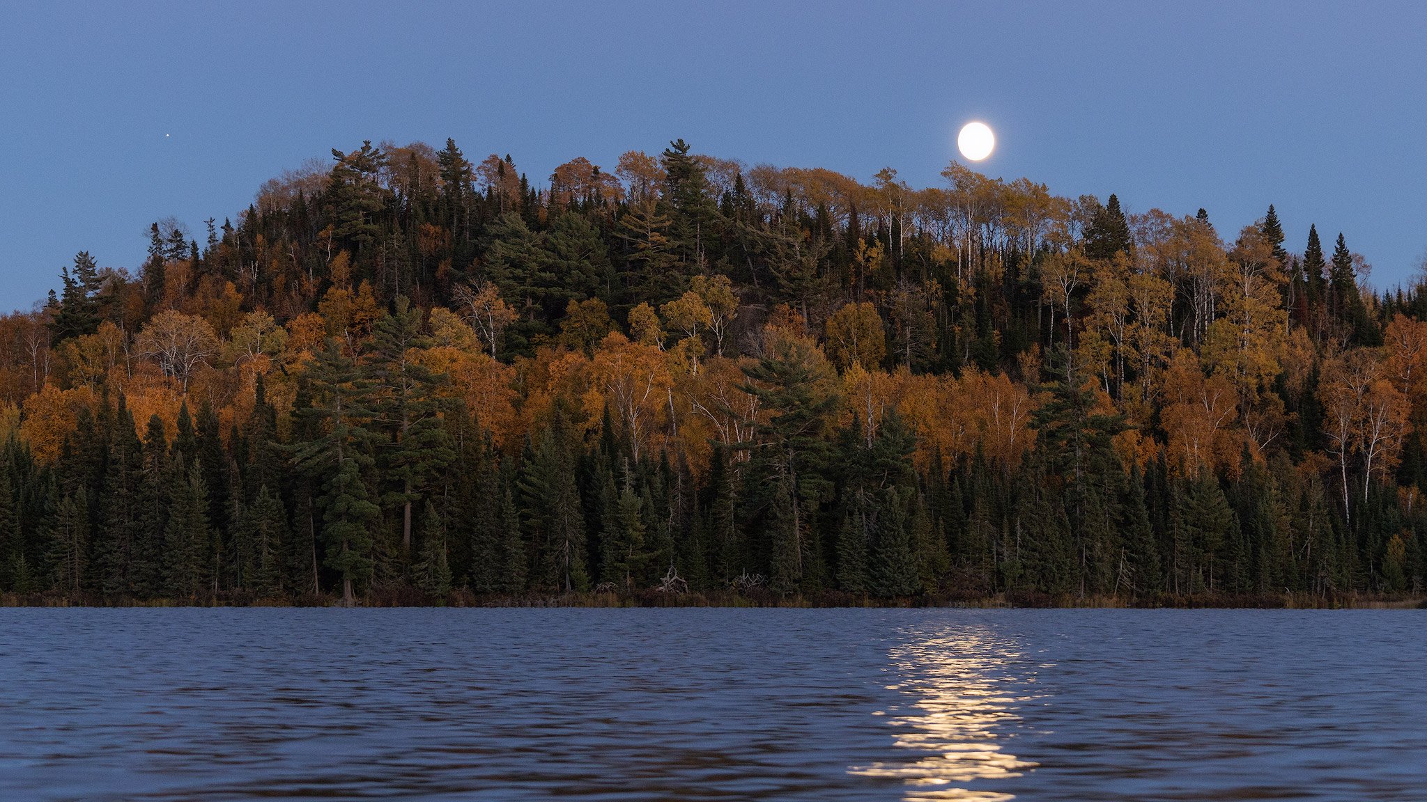
Fall: Campsite use falls off dramatically after Labor Day. Fall colors usually peak in late September/early October. Bears become more active in September and October as they prepare for winter.
Winter: Conditions can be extreme and dangerous. Trailheads may not be plowed. Backpacking is recommended for experienced winter backpackers only.
Conditions by Section
This information is updated by the Border Route Trail Association as soon as possible with current trail reports.
Even after the trail is cleared, portions can become heavily overgrown again, especially in the summer months. Be prepared for a windshield wiper effect through ferns and thimbleberries.
-
The western 15.8 miles of this section are outside of the BWCAW; the eastern 0.2 miles are within the BWCAW.
May 8-11 2025
Day 1-Our crew of 4 cleared 3 miles from Loon Lake Road to Bridal Falls. Cut and cleared 11 trees from the trail, and brushed all the way out.
Day 2- Three of us cleared from Loon Lake Landing on BRT to South Rim trail and all the way back to Hestons resort on BRT. We cut and cleared 28 deadfalls, and brushed the entire section. We also cleared the cut across 1/2 mile trail from west side of Loon Lake road to junction of main BRT trail. We cleared a total of 6 miles.
Day 3- We bolted a new wood BRT trail sign at Loon Lake Landing.
Approximately 9 total miles of BRT cleared.
In May 2025, the trail was cleared from Western Terminus to the N Gunflint Lane.
May 2025 - Bryce Breon (N Loon Lake Spur Trail) was cleared from the Loon Lake Landing to the Border route trail. The trail west from this junction back to Loon Lake Landing has down trees crossing the path at various points.
May 2025 - some down trees from Bryce Breon junction to end of Loon Lake - otherwise clear.
In October 2023, a crew cleared from Loon Lake to Bridal Falls, the Cross River Trail, and the Brice-Breon Trail.
May 2023 clearing trips were canceled due to lingering winter conditions. Significant signage work remains to be completed in the congested Gunflint Cliffs area.
In May 2022, deadfalls were cleared in the non-wilderness portion. New signage was also installed from Gunflint Trail to the South Rim, including adding blue blazes on select rock surfaces.
-
All 14 miles of this section are within the BWCAW.
MAY 2025
Bridal Falls Spur trail is brushy but pretty much free of trees. It will be a carwash when the leave come out.
Bridal Falls to W Crab Lake Spur: Brushy with intermittent big deadfalls from fire trees. Big, but easy walk overs.
From just west of west Crab Lake spur to just east of east Crab Lake spur, intermittent down large trees with at least two pretty significant carwash sections. These will be thick when the leaves come out.
Mucker Lake area: From just W of Mucker to just E of Mucker, there is a lot of work needed due to a blow down in this area. It was easy to find the trail and walk around, but this area needs work.
There is also a huge white pine across the trail just W of the Creek crossing.
The spur to Partridge Lake Camp was almost tree free. The spur is getting brushy and could use some lopper work.
Stairway Portage to the east, there were a couple of carwash areas that will be thick when the leaves come out.
On the ridge beginning around overlook *V18 on the BRT map, there is a severe blowdown that starts on the ridge and goes downhill as you are heading east, descending towards Rose Lake W camp. We put the saws away and picked our way through this area. We did not have problems finding the trail, but this area is a mess with a lot of big trees.
W Rose camp to E Rose Camp: Medium/high level downed trees in terms of frequency.
I do not recall any huge trees. Easy to stay on the trail. Also: Carwash area from about V5 to V8 on the BRT map.
2023
A small volunteer crew cleared brush and over 10 deadfalls between Sock Lake and Topper Lake campsites in September 2023. The spur trail to Sock Lake campsite was also mostly cleared.
Trail crews cleared between Crab Lake Cutoff Trail and Sock Lake Campsite Spur as well as between South Lake Trail and Stairway Portage in May 2023.
Conditions to be aware of:
Crab Lake area: Heavy brush for a couple short stretches in this area.
Topper Lake Cutoff (Mucker Lake Trail) to Sock Lake Campsite Spur (0.65 miles): Heavy brush for a couple short stretches; 2 large leaning trees and 1 large stepover.
Mucker Lake flow: Flooding may occur due to spring melt or after heavy rains. A large tree 100 yards upstream can be used if rock hopping is not possible; cross at your own risk.
About 0.75 miles west of Stairway Portage: Flooding may occur at a shallow saucer pond due to spring melt. Tree debris on the south side of the trail can be used for crossing.
Long Portage about 0.5 miles west of Daniels Lake Spur: The trail is flooded at a beaver pond for about 150 yards. Deepest depth was about two feet in August 2022; water levels will be higher after spring melt or heavy rains. The footpath underneath is solid and mostly flat.
-
The western 22.1 miles are within the BWCAW; the eastern 0.8 mile is outside the BWCAW.
15 - 18 MAY 2025
We found the main trail in great shape. Most of our time was cutting back encroaching brush. We cut about five 3-4” trees. We worked east 2 miles until we found signs of recent work. The trees that were down had fresh cuts so we returned to camp. 3 and 1/2 hours worked. Retired early because of the cold. It rained most of the night.
5/17/2025
We cleared the spur. Lots of encroaching brush and cut our biggest tree of the trip at 5” diameter. We left a 25” tree, it was hung up and too dangerous for us to tackle, plus a trail was already established around the fallen tree. We gained the main trail and headed west. There were very few trees down, about 4, all 4” diameters. Spent a lot of time on brushing. About half way thru Rove Lake we found a blowdown of about 100’ that someone had been working on. They had it nicely cleared so we stopped at that point and returned to camp. Worked 61/2 hours. We had a rain free evening and Jim got another toasty fire going. Bed by 9 with all the extra clothes I had. Sleet started about midnight.
5/18/2025
We woke up to snow on Sunday morning. Broke camp and paddled back to Clearwater Lodge in snow.
2025 MAY -
The Daniels Lake spur is excellent. There are some down trees, but nothing significant. Much drier than last year.
In early fall 2023, a crew from the Conservation Corps Minnesota and Iowa cleared starting at the Pine Ridge Campsite heading westward, ending about halfway between the Pine/West Pike Lake Portage and Gogebic Lake. A scouting report in September 2023 counted 64 deadfalls between the Daniels Lake Trail Spur and the eastern terminus, with the worst above Clearwater Lake.
Trail crews cleared between McFarland/East Pike Lakes Portage and McFarland Lake Campground in May 2023.
The October 2021 tornado damage to the Clearwater Lake area was cleared and the trail was open to hiking as of June 2022.
Conditions to be aware of:
Tornado damage area (1.3 miles): There are multiple trees needing to be cleared west of and to the Mountain/Clearwater Lakes Portage.
South of Gogebic Lake: The trail crosses over a beaver dam. In wet periods, the pond leaks around the east end.
Gogebic Campsite to V31 (2 miles): Medium to heavy brush.
-
All 12.3 miles in this section are outside of the BWCAW.
May 15-17, 2026
Location: East End, Non-Wilderness (mechanized)Basecamp: McFarland Lake Campsite
Coordinated by Gary Carlson and Pam Tavernier
Team members: Friday & Saturday 11, Sunday 9
This was a very successful trip with a great crew with total mileage of 13 miles. We have now completed our Spring sweep of all 30 miles of the non-wilderness BRT.
Base Campsite-The McFarland Lake State Forest campsite is primitive with 5 campsites, fire rings, one vault toilet, and picnic tables. There are no garbage facilities or drinking water so we bring our own. There is boat access and a dock. This is a great location to access the Border Route Trail and the Boundary Waters. We shared camp with a couple of groups of people fishing and an individual planning to start a thru hike of the SHT.
Day 1-Our crew of 11 divided into two teams working with handsaws and loppers only. No chainsaws or brush cutters due to the RED FLAG WARNING and extreme dryness. Team one started at the eastern terminus, hiked to the 270 overlook clearing deadfalls along the way. We met two day hikers at the overlook and shared the awe of the scenery. The team then proceeded to continue work clearing deadfalls, cutting limbs and branches and lobbing brush. A total of 25 deadfalls were removed from the 5 mile section of trail. Returned to the basecamp at McFarland at 5:40 pm. A full day. Temperature reached approximately 70 degrees for a high.
Team 2 began at Otter Lake and proceeded with the work of clearing deadfalls, lobbing and limbing working towards both the Stump River and Portage Brook Bridges. Once again, we discovered the Portage Brook Bridge floated due to record breaking Pigeon River floods. Both bridges received new capacity limit signs that say Caution Maximum Load Two People Separately. An out and back hike of about 6 miles.
The evening of Day 1 we received a message about the forest fire just north of Two Harbors necessitating closure of Highway 61 from Silver Bay to Two Harbors. There was an approximate 45 minute detour that would need to be added to our already 5 hour drive to return home. Two individuals would add that detour to a 7 hour trip.
Day 2- We kept the same teams but today we took chainsaws due to cooler temperatures. Both teams drove to South Fowl Lake access. Team 1 worked west towards McFarland clearing 48 deadfalls along with usual work over 4.6 miles. Team 2 went east along South Fowl Cliffs doing the same. The McFarland Lake campsite kiosk was updated and a Carsonite trail post was replaced due to snowplow damage.
Temperatures were cooler this day which made for more pleasant working conditions. The Two Harbors fire report remained unchanged.
Day 3-Team 1 accessed the Border Route Trail from McFarland and cleared into the boundary waters. Due to time constraints we did not make it to the first campsite but we cleared 15 deadfalls and enjoyed beautiful vistas. We also met a thru hiker that was on day 2.
Team 2 hiked to areas and replaced damaged/vandalized signposts and updated the kiosk at the eastern terminus.
We are thankful and humbled by the quality of volunteers that we get to help us. We could not maintain the Border Route Trail without you
MAY 2025
One of the paramount decisions around this trip was the decision to proceed. The three forest fires in northeast Minnesota and dry conditions were of a major concern. We felt with the forecast of rain and cooler temperatures we could proceed with the trip. It did rain Thursday night and it got cooler. It rained Friday night also. By Sunday morning, it was 30 degrees, snowing and raining.
Team members: Day 1- 6, Day 2 - 9
The McFarland Lake campground is primitive with 5 campsites, fire rings, one vault toilet, and 2 picnic tables. There are no garbage facilities. You must also bring your own water unless you want to filter water out of the lake. There is lake access and a dock. This is a great location to access the Border Route Trail and the Boundary Waters.
Our crew of 6 updated the kiosk at McFarland Lake. The crew then proceeded onto the Border Route Trail and headed east. The work of heavy brushing, clearing of deadfalls, lopping limbs, blazing, and carrying equipment.
On Day 2 two groups drove to South Fowl Lake. The team worked their way west on the trail along the Pigeon River with the goal of meeting up with the first group. This is called a pincer movement. Heavy brushing with brush cutters, deadfall clearing and lopping were done by both teams.
Day 3- We woke up to snow and ice on our tents. Snow covering the picnic table. The light fluffy stuff alternating with rain and 30 degrees temperatures. The weather report was for these conditions to continue until noon. (This was to be a half day). After discussion and reviewing the pros and cons with the team, the decision was made to cancel the work for this day.
The kiosk on the Eastern Terminus was updated. We also met a driver for Superior By Nature dropping off a section hiker for the SHT here.
MAY 2024
We cleared from the Eastern trailhead to Otter Lake Junction and exited out there. Saturday cleared from Otter Lake access trail and installed signage for BRT/NCT. Cleared approximately to 1/2 mile past Stump River.
McFarland trailhead and proceeded east to Superior National Forest access road.
Basic deadfall sweep, brush cutting with loppers, blue blazes and carsonite sign post installation.
Trail crews cleared most of this section in May 2023; about 2 miles from Stump River to Otter Lake Trail Access were not cleared. Several new carsonite sign posts and North Country Trail/Border Route Trail signs were installed at the bridge by McFarland Lake Campground heading westbound. Kiosks at McFarland Lake Campground and the eastern terminus were also updated with entirely new information and map copies.
Bridges at Portage Brook and Stump River are each limited to two people at a time. Both bridges were repaired in August 2022 after sustaining significant damage from spring 2022 flooding (see May 2022 report).
-
MAY 2024
The portion of the South Lake Trail from Rockwood Lodge to the BWCA border is in fair condition. There remains one fallen tree just after the Geological Survey marker where the trail reconnects to the original trail.
The portion of the BRT East of the intersection with the South Lake Trail and west of the intersection with the East Partridge Lake campsite trail has not been cleared in a number of years and that is very evident in the level of brush encroaching on the trail.
The portion of the BRT west of Stairway Portage to the intersection with the East Partridge Lake campsite trail and the campsite trail are clear
-
Date: June 7, 2025
On Saturday, National Trails Day, six volunteers had an enjoyable workday completing a hike and deadfall sweep of six miles of the Border Route Trail between the Otter Lake access trail and the Eastern terminus/SHT junction. The team also checked on the Portage Brooke Bridge near the Pigeon River/Canadian border. Although we had hoped the “just one day” trip could draw a larger group to allow a full brush clearing of this section, the two groups of three completed about 30 deadfall removals and other lobber trimming and clean up. We also cleared an overlook above the pristine Lonely Lake, one of the highlights of this section.
Of the 65 miles of the Border Route Trail, we have completed hiking and maintaining 28 miles of the non-wilderness sections this spring with 18 volunteers over 7 work days. Six of these individuals volunteered for two or three separate trips.
There is a total of 30 miles of non-wilderness trail. Two miles are left to clear which will be left until fall along with brushing the six mile section just cleared.
Please join us on a trip in September or October when the colors should be amazing and our friendly neighbors (black flies, mosquitoes and ticks) will be less abundant!
We are grateful to the volunteers that dedicated a weekend or more to work with us this spring. Thank you.
Gary Carlson and Pam Tavernier
-
Date: May 1-3, 2026
Location: North Country National Scenic Trail, Border Route Trail section-West end of the Gunflint Trail
Type of trip: Non-wilderness (mechanized)
Basecamp: Cross River Campsite
Coordinators: Gary Carlson and Pam Tavernier
Total Team Members-13
Base Campsite-Cross River Campsite-US Forest Service Road 1347 (also Gunflint Narrows) is a delightful, private, rustic campsite with its own gravel pit and USFS wilderness toilet complete with the sounds of the Cross River flowing in the background. No other services are available. Cell service with ATT was available at this site. Verizon and T-mobile did not work in this area.
Day 1-Location of work: South Rim Trail. Team one started at Loon Lake Landing with one Billy Goat (industrial mower), one brush cutter, loppers, hand saws, and fuel for the equipment. Team two started at Heston’s Lodge access point and worked west with the same equipment as team one. The work was cutting brush, clearing deadfalls, cutting limbs that were growing into the trail, refreshing/adding blue blazes, and carrying fuel for the equipment. The two teams met in the middle (pincher move) at approximately 1400. Three more volunteers descended upon us on the trail at this time and relieved some of the work with the more difficult equipment (think Billy Goats). We elected not to carry chainsaws on this trip and thankfully were met with minimal deadfalls . The few that we did come upon were manageable with handsaws. We were back to the campsite by 1800. One more volunteer joined us that evening. Five miles completed. Chili (made by Gary and Pam) with the fixings of wonderful corn bread muffins and brownies provided by Rebecca Fitch (secretary of the BRTA) was enjoyed for dinner along with a celebratory beer.
Day 2-Location of work: Magnetic Rock Trailhead to Gunflint Narrows entry point. Team one started at the Gunflint Narrows entry site with the same equipment minus the Billy Goat due to this section of trail being difficult to use this equipment on. Team two started at the Magnetic Rock Trailhead also minus the Billy Goat. Each team was then able to use two brush cutters. The two teams met at Magnetic Rock for lunch. While we were there six day hikers visited Magnetic Rock. Chainsaws were not used this day either. The minimal deadfalls were taken care of with handsaws. The Silky saws really are impressive! The kiosk at the Magnetic Rock Trailhead was updated with new signage and maps. The sun and weather damage the signage necessitating replacement yearly. Teams arrived back at camp at approximately 1700. We had a special dinner this evening provided by Barb Gecas from Heston’s Lodge complete with lasagna, salad, garlic bread, and chocolate chip bars. This was an exceptional meal in the environment of being outdoors, hard work, and working with new and old friends. Like, best lasagna ever! Four miles completed.
Day 3-This was a partial day-Trail maintenance was completed from the Cross River bridge at Gunflint Lake to the UT 46 junction. This section of trail passes a lovely section of the Border Route Trail overlooking a raging Cross River. Signage and the western terminus kiosk was updated and the pedestal base was straightened. Approximate mileage-2 miles.
Temperatures at night dropped to 28 degrees Fahrenheit. The tents had frost on them in the morning. The temperatures reached the high 40’s to the high 50s over the weekend. Perfect working weather. We only saw a few mosquitoes. Yes, there were tick sightings. It was a great trip on this most beautiful trail! The Border Route Trail is an exceptional wilderness trail maintained by volunteers. This trail is considered the crown jewel of the North Country National Scenic Trail.
-
Trail clearing trip report for May 14-17 on Rose Lake from Staircase Portage east to the easternmost canoe campsite. There were two groups.
Group 1 - Rose Lake group
Day 1- We canoed to Duncan Lake from Hungary Jack. We had the thrill of breaking through about 100 yards of ice before reaching our campsite end setting up camp. We then preceded to head up to one of the best overlooks in Boundary waters almost 700 feet above Rose lake as seen in the video. We cleared storm damage and did some small rerouting to make it safer trip to such a great view.
Day 2- This was the longer distance day clearing several blowdowns, trail obstructions, head smackers, overgrowth, bigger crosscuts remaining from the storm two years ago( there are still some hop/climb overs and a go under that were out of safe capabilities) and general maintenance from staircase to the easternmost canoe sight. It was an 8 mile day and we earned our dinner after a windy canoe ride back to camp.
Day 3- This was lopper overgrowth day. We didn’t put the same distance in but felt equal satisfaction of accomplishment. The corridor was widened in several well needed spots and the hamstrings felt it. We also fixed the wobbly railing to the bridge above the falls. The good thing about see your breath nights is I didn’t have to worry about bugs with the hammock.
Day 4- We broke camp and paddled into the wind seemingly on every lake back. We treated ourselves with a scamper up Caribou rock trail for one last overlook clearing trail debris along the way of course. I couldn’t have asked for a better crew. Other than the nature, pride of productivity, and burning some winter fat the greatest part of these trips is a chance to meet some great people. I had a chance to share stories and learn from Jill, Ann, and John. Thanks for your time and effort. It was a blast.
Group 2 - Daniel’s and Rove Lake
May 14-17-2026
Base camp: Group was split in two, one camped on Duncan and the second on Daniels
Team members: Total of 8, four on Rose and four on Rove.
Coordinated by: Steve Busch with assist from Tom Reichert
Day 1: All 8 of us arrived at Hungry Jack Outfitters on May 13. Hungry Jack set us up with 2 bunkhouse rooms. We had a group dinner at Hungry Jack Lodge and went to bed early.
Day 2: The outfitter brought us breakfast at 7, in time for us to see the frost on our cars. We packed our gear and met in the parking lot to discuss plans for the weekend, safety in icy waters, safety during clearing, how I thought the team should be divided, and the outfitter explained how to care for the canoes he supplied us with. We were on the water by 9.
At this point Tom Reichert took over the Rose Lake group and he has filed a separate report.
My team headed for Daniels and Rove Lake. We set up our base camp and had lunch all by 1 PM. We were camped on a spur trail so we could walk to our work site. We cleared about 1.5 miles that afternoon. About 10 manageable trees. The evening was great. We ate, talked, and had a fire. It rained that night but it was over by morning.
Day 3: We continued clearing to the Clearwater campsite trail. Another 20 trees. We got to build our first step thru a large tree, no chance we were going to be able to remove it but the step did the trick for us and I am sure it will work for hikers. There were two alder thickets which we lopped. Our work was completed so we returned to camp, it was not sheltered and the wind was strong. No fire for us that night. We planned to get up early to beat the wind and hoped to meet the other group at their site and help them finish.
Day 4: We were on the lake by 8:30. The waves and wind seemed manageable until the dog leg on the lake. We had to hug the shore and paddle hard to get to the portage. We portaged to Bearskin and tried to get to the Duncan portage but were stopped by wind and white caps. Our only option was to return to the outfitter. Everyone in the Duncan group had experience so I was confident they would not try to return in the terrible conditions. They did not. They found enough work to keep busy all day.
Day 5. The wind died down and the other group returned safely to the outfitter about 1 PM. Everyone had time for a shower, a recap of the weekend, and some took lunch at Trail Center. The forest fire near Two Harbors closed Hwy 61. The detour added some time to our return trip but we didn’t see or smell a fire,
Hungry Jack Outfitters deserves a call out. They helped us with a bunkhouse, with advise, with canoes, And best of all one of the owners hitched a ride with the Duncan Lake group and helped get them thru 100 yards of ice blocking the campsite. Couldn’t have done it without them.